 https://arlhist.org/wp-content/uploads/2025/07/Arlington-1947-scaled.jpg
2560
2141
Peter Vaselopulos
/wp-content/uploads/2024/07/arlhist-logo-cm-02.png
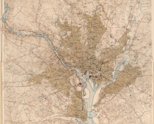
Peter Vaselopulos2025-07-09 20:16:562025-07-11 14:28:37Department of Interior 1944 Map
https://arlhist.org/wp-content/uploads/2025/07/Arlington-1947-scaled.jpg
2560
2141
Peter Vaselopulos
/wp-content/uploads/2024/07/arlhist-logo-cm-02.png
Peter Vaselopulos2025-07-09 20:16:562025-07-11 14:28:37Department of Interior 1944 Map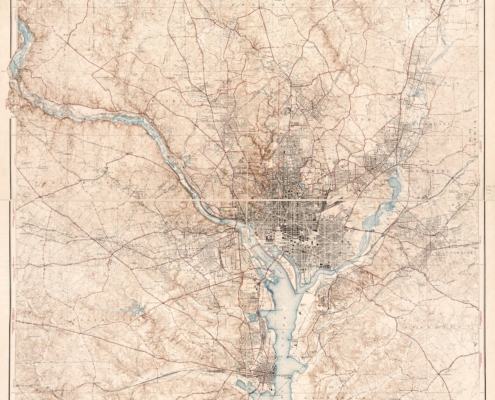 https://arlhist.org/wp-content/uploads/2025/07/Arlington-1932-scaled.jpg
2560
2234
Peter Vaselopulos
/wp-content/uploads/2024/07/arlhist-logo-cm-02.png
Peter Vaselopulos2025-07-09 19:56:382025-07-11 14:26:44Urban Growth Map
https://arlhist.org/wp-content/uploads/2025/07/Arlington-1932-scaled.jpg
2560
2234
Peter Vaselopulos
/wp-content/uploads/2024/07/arlhist-logo-cm-02.png
Peter Vaselopulos2025-07-09 19:56:382025-07-11 14:26:44Urban Growth Map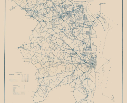 https://arlhist.org/wp-content/uploads/2025/07/Arlington-1920.webp
1600
1341
Peter Vaselopulos
/wp-content/uploads/2024/07/arlhist-logo-cm-02.png
Peter Vaselopulos2025-07-09 19:12:472025-07-10 08:29:57Arlington 1920
https://arlhist.org/wp-content/uploads/2025/07/Arlington-1920.webp
1600
1341
Peter Vaselopulos
/wp-content/uploads/2024/07/arlhist-logo-cm-02.png
Peter Vaselopulos2025-07-09 19:12:472025-07-10 08:29:57Arlington 1920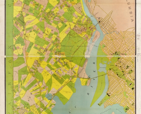 https://arlhist.org/wp-content/uploads/2025/07/Virginia-Title-Map-scaled.jpg
2560
1686
Peter Vaselopulos
/wp-content/uploads/2024/07/arlhist-logo-cm-02.png
Peter Vaselopulos2025-07-09 18:59:402025-07-16 21:08:14Map of Alexandria County
https://arlhist.org/wp-content/uploads/2025/07/Virginia-Title-Map-scaled.jpg
2560
1686
Peter Vaselopulos
/wp-content/uploads/2024/07/arlhist-logo-cm-02.png
Peter Vaselopulos2025-07-09 18:59:402025-07-16 21:08:14Map of Alexandria County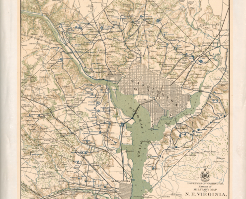 https://arlhist.org/wp-content/uploads/2025/07/Defenses-of-Washington-scaled.jpg
2560
2021
Peter Vaselopulos
/wp-content/uploads/2024/07/arlhist-logo-cm-02.png
Peter Vaselopulos2025-07-09 16:54:042025-07-10 08:19:26Civil War Defenses of Washington 1865
https://arlhist.org/wp-content/uploads/2025/07/Defenses-of-Washington-scaled.jpg
2560
2021
Peter Vaselopulos
/wp-content/uploads/2024/07/arlhist-logo-cm-02.png
Peter Vaselopulos2025-07-09 16:54:042025-07-10 08:19:26Civil War Defenses of Washington 1865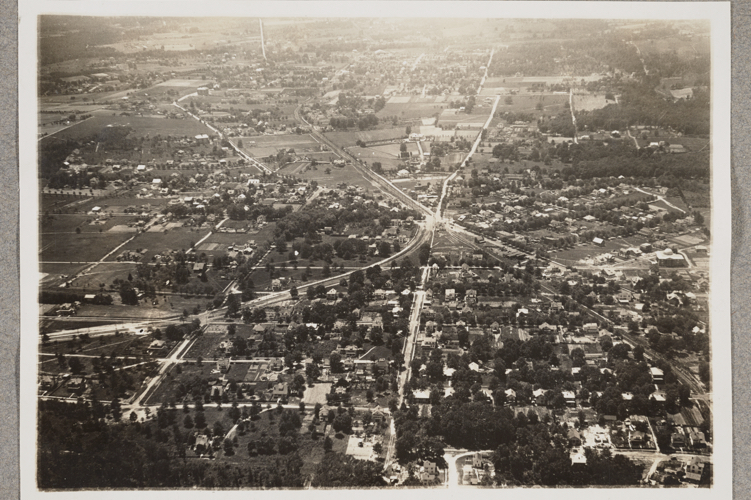 https://arlhist.org/wp-content/uploads/2023/10/Aerial-Arlington.jpeg
500
751
Peter Vaselopulos
/wp-content/uploads/2024/07/arlhist-logo-cm-02.png
Peter Vaselopulos2025-07-09 12:25:392025-08-21 15:22:55Arlington County, VA 1920
https://arlhist.org/wp-content/uploads/2023/10/Aerial-Arlington.jpeg
500
751
Peter Vaselopulos
/wp-content/uploads/2024/07/arlhist-logo-cm-02.png
Peter Vaselopulos2025-07-09 12:25:392025-08-21 15:22:55Arlington County, VA 1920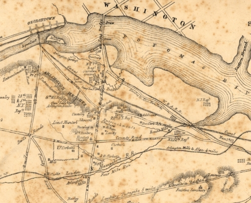 https://arlhist.org/wp-content/uploads/2025/04/Corbett-Map-scaled.jpg
1311
2560
Peter Vaselopulos
/wp-content/uploads/2024/07/arlhist-logo-cm-02.png
Peter Vaselopulos2025-07-08 22:59:122025-07-11 14:30:18Seat of War Map
https://arlhist.org/wp-content/uploads/2025/04/Corbett-Map-scaled.jpg
1311
2560
Peter Vaselopulos
/wp-content/uploads/2024/07/arlhist-logo-cm-02.png
Peter Vaselopulos2025-07-08 22:59:122025-07-11 14:30:18Seat of War Map https://arlhist.org/wp-content/uploads/2025/04/IMG_4931-scaled.jpeg
1920
2560
Peter Vaselopulos
/wp-content/uploads/2024/07/arlhist-logo-cm-02.png
Peter Vaselopulos2025-06-05 07:42:442025-06-05 07:42:44Membership Drive
https://arlhist.org/wp-content/uploads/2025/04/IMG_4931-scaled.jpeg
1920
2560
Peter Vaselopulos
/wp-content/uploads/2024/07/arlhist-logo-cm-02.png
Peter Vaselopulos2025-06-05 07:42:442025-06-05 07:42:44Membership Drive https://arlhist.org/wp-content/uploads/2025/05/f20bcf5d80b26a5d7ed579caf2e55ac3b43a9d09.jpeg
943
1570
Peter Vaselopulos
/wp-content/uploads/2024/07/arlhist-logo-cm-02.png
Peter Vaselopulos2025-05-28 16:44:102025-05-29 07:45:40MEA Website
https://arlhist.org/wp-content/uploads/2025/04/Corbett-Map-scaled.jpg
1311
2560
Peter Vaselopulos
/wp-content/uploads/2024/07/arlhist-logo-cm-02.png
Peter Vaselopulos2025-04-17 09:50:502025-08-23 21:11:41Virgil P. Corbett
https://arlhist.org/wp-content/uploads/2025/05/f20bcf5d80b26a5d7ed579caf2e55ac3b43a9d09.jpeg
943
1570
Peter Vaselopulos
/wp-content/uploads/2024/07/arlhist-logo-cm-02.png
Peter Vaselopulos2025-05-28 16:44:102025-05-29 07:45:40MEA Website
https://arlhist.org/wp-content/uploads/2025/04/Corbett-Map-scaled.jpg
1311
2560
Peter Vaselopulos
/wp-content/uploads/2024/07/arlhist-logo-cm-02.png
Peter Vaselopulos2025-04-17 09:50:502025-08-23 21:11:41Virgil P. Corbett