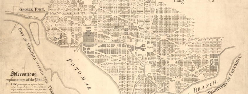
Step into the moment Arlington helped shape the nation’s capital. In 1791, surveyors under President George Washington mapped a 100-square-mile federal district along the Potomac River, placing forty sandstone boundary stones; some of which still stand in Arlington today. Learn about the people who surveyed and mapped this land.
The Arlington Historical Museum is commemorating 250+ years of local history. This exhibit is upstairs on the 2nd floor of the museum.
The Museum is open Saturdays 10-4 PM and Sundays 1-4 PM.
It’s FREE!