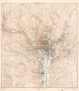
 This is a map published in 1932—though the original dates back to 1929—a little over a decade after Arlington became its own county. It was created by the Federal Department of the Interior. Compared to earlier maps, this one shows more urbanization and less open space or farmland in Arlington County. This reflects a shift from rural to urban areas and a growing population, a trend that continues today. In 1930, new zoning laws gentrified parts of Arlington—especially Hall’s Hill, where a wall was built to enforce segregation between white and Black residents. This wall remained until 1966, when parts of it began to be demolished.

 Department of Interior 1944 Map