 https://arlhist.org/wp-content/uploads/2025/10/40e7ba6dcb73fe7267d6a208e2993445.jpg
400
400
Adam Ide
/wp-content/uploads/2024/07/arlhist-logo-cm-02.png
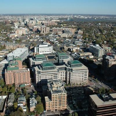
Adam Ide2025-10-22 09:42:522026-05-19 09:11:01The Story of Smart Growth and the Metro
https://arlhist.org/wp-content/uploads/2025/10/40e7ba6dcb73fe7267d6a208e2993445.jpg
400
400
Adam Ide
/wp-content/uploads/2024/07/arlhist-logo-cm-02.png
Adam Ide2025-10-22 09:42:522026-05-19 09:11:01The Story of Smart Growth and the Metro https://arlhist.org/wp-content/uploads/2025/10/fed09eb9901d7c2abc470ba67386ab05.jpg
400
400
Adam Ide
/wp-content/uploads/2024/07/arlhist-logo-cm-02.png
Adam Ide2025-10-22 09:33:242025-10-24 14:13:32J. Walter Tejada
https://arlhist.org/wp-content/uploads/2025/10/fed09eb9901d7c2abc470ba67386ab05.jpg
400
400
Adam Ide
/wp-content/uploads/2024/07/arlhist-logo-cm-02.png
Adam Ide2025-10-22 09:33:242025-10-24 14:13:32J. Walter Tejada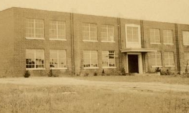 https://arlhist.org/wp-content/uploads/2025/10/4f3e14aa3d980c287da15a26d7fbe98f-e1761052064425.jpg
233
388
Adam Ide
/wp-content/uploads/2024/07/arlhist-logo-cm-02.png
Adam Ide2025-10-21 09:10:302025-10-29 09:48:03The Jefferson School
https://arlhist.org/wp-content/uploads/2025/10/4f3e14aa3d980c287da15a26d7fbe98f-e1761052064425.jpg
233
388
Adam Ide
/wp-content/uploads/2024/07/arlhist-logo-cm-02.png
Adam Ide2025-10-21 09:10:302025-10-29 09:48:03The Jefferson School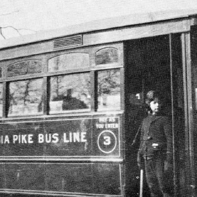 https://arlhist.org/wp-content/uploads/2025/10/d62bc7a15d6e1d25e6846f88fd67a394.jpg
400
400
Adam Ide
/wp-content/uploads/2024/07/arlhist-logo-cm-02.png
Adam Ide2025-10-21 09:04:372025-10-29 09:48:51Columbia Pike Bus Line
https://arlhist.org/wp-content/uploads/2025/10/d62bc7a15d6e1d25e6846f88fd67a394.jpg
400
400
Adam Ide
/wp-content/uploads/2024/07/arlhist-logo-cm-02.png
Adam Ide2025-10-21 09:04:372025-10-29 09:48:51Columbia Pike Bus Line https://arlhist.org/wp-content/uploads/2025/10/560626354_1425477619166555_1885662404544325635_n.jpg
480
480
Peter Vaselopulos
/wp-content/uploads/2024/07/arlhist-logo-cm-02.png
Peter Vaselopulos2025-10-17 14:03:392025-10-17 14:05:49AHS 2025 Annual Banquet
https://arlhist.org/wp-content/uploads/2025/10/560626354_1425477619166555_1885662404544325635_n.jpg
480
480
Peter Vaselopulos
/wp-content/uploads/2024/07/arlhist-logo-cm-02.png
Peter Vaselopulos2025-10-17 14:03:392025-10-17 14:05:49AHS 2025 Annual Banquet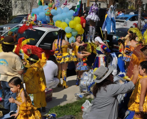 https://arlhist.org/wp-content/uploads/2025/10/Bolivian-Dance-Parade-2014-0569.webp
665
1000
Adam Ide
/wp-content/uploads/2024/07/arlhist-logo-cm-02.png
Adam Ide2025-10-17 09:37:052025-10-29 09:50:16Columbia Pike Exhibit Turns the Lens on Vibrant Northern Virginia Region
https://arlhist.org/wp-content/uploads/2025/10/Bolivian-Dance-Parade-2014-0569.webp
665
1000
Adam Ide
/wp-content/uploads/2024/07/arlhist-logo-cm-02.png
Adam Ide2025-10-17 09:37:052025-10-29 09:50:16Columbia Pike Exhibit Turns the Lens on Vibrant Northern Virginia Region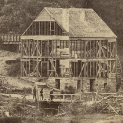 https://arlhist.org/wp-content/uploads/2025/10/229a8d3ef09a5df365b170f51ecd9895.jpg
400
400
Adam Ide
/wp-content/uploads/2024/07/arlhist-logo-cm-02.png
Adam Ide2025-10-14 10:03:152025-10-29 09:52:20Skirmish at Arlington Mill
https://arlhist.org/wp-content/uploads/2025/10/229a8d3ef09a5df365b170f51ecd9895.jpg
400
400
Adam Ide
/wp-content/uploads/2024/07/arlhist-logo-cm-02.png
Adam Ide2025-10-14 10:03:152025-10-29 09:52:20Skirmish at Arlington Mill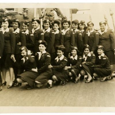 https://arlhist.org/wp-content/uploads/2025/10/eddedd2852fec29a45af4f2b6c01a3e1.jpg
400
400
Adam Ide
/wp-content/uploads/2024/07/arlhist-logo-cm-02.png
Adam Ide2025-10-14 09:50:102025-10-29 09:53:16America’s First All-Women Swing Band Lived in Arlington
https://arlhist.org/wp-content/uploads/2025/10/eddedd2852fec29a45af4f2b6c01a3e1.jpg
400
400
Adam Ide
/wp-content/uploads/2024/07/arlhist-logo-cm-02.png
Adam Ide2025-10-14 09:50:102025-10-29 09:53:16America’s First All-Women Swing Band Lived in Arlington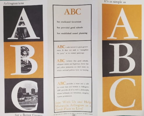 https://arlhist.org/wp-content/uploads/2025/10/20250722_090508-scaled.jpg
2037
2560
Peter Vaselopulos
/wp-content/uploads/2024/07/arlhist-logo-cm-02.png
Peter Vaselopulos2025-10-03 15:01:442025-10-19 08:27:16ABC
https://arlhist.org/wp-content/uploads/2025/10/20250722_090508-scaled.jpg
2037
2560
Peter Vaselopulos
/wp-content/uploads/2024/07/arlhist-logo-cm-02.png
Peter Vaselopulos2025-10-03 15:01:442025-10-19 08:27:16ABC https://arlhist.org/wp-content/uploads/2025/10/Location-of-Family-Tea-House-scaled.jpg
1920
2560
Peter Vaselopulos
/wp-content/uploads/2024/07/arlhist-logo-cm-02.png
Peter Vaselopulos2025-10-03 11:00:282025-10-03 16:20:56Family Tea House
https://arlhist.org/wp-content/uploads/2025/10/Location-of-Family-Tea-House-scaled.jpg
1920
2560
Peter Vaselopulos
/wp-content/uploads/2024/07/arlhist-logo-cm-02.png
Peter Vaselopulos2025-10-03 11:00:282025-10-03 16:20:56Family Tea House